One of the challenges with purchasing Hagg Leys Farm is that we do not have any property details. We bought the property before the details had been produced and once the property had been sold, there was no interest in producing these. So we are having problems answering basic questions such as “how many sq ft is the property?”, “How big is the garden?” etc.
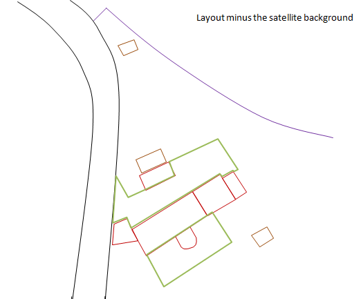
As it turns out, the square footage is an important factor in estimating a number of the basic costs so it is important to be able to get an estimate of this, no matter how rough. It occurred to me that Google Earth might be a good option here. I zoomed in on the property as much as I could and grabbed the bitmap (using the snipping tool in Windows 7). I then pasted this into PowerPoint and drew around the outline of the buildings including other features such as the access road and outbuildings. You can then remove the underlining satellite image to reveal the outline of the property plan.
Two important things to remember. Firstly, if you shrink the bitmap, make sure that you keep the proportions the same. Secondly, when you grab the bitmap make sure that you include the scale. If you do this, you should be able to mention the outline of the buildings. Using this approach, I managed to estimate that the square footage of the existing building is around 2700 sq feet (excluding the unconverted barn). I could also start to building some outline designs for the renovation as well as calculating the potential increase in square footage. I used this to provide some illustrations to the architect and it turned to be a really useful process.