Category: Huddersfield local council

The farm today

Here’s some photographs of the property as it is today.  It is organised as a small attached cottage, a larger cottage and an unconverted barn.  All on a 2 acre plot of land.

From the road.  The odd shaped building to the right of the picture is a coal hole.  This odd shaped part of the building seems to be fairly original as it appears on even the oldest of the maps that we have found. Take a close look at the 1788 map, particularly where the property adjoins the road. The porch is for the small attached cottage.

From the back of the property.  This is the view from the back of the top field.  The unconverted barn is at this end of the property.  It has clearly been rebuilt in recent years, but is still unconverted.  The lower photograph is the rear of the property, but this time from the bottom field looking up.  The odd shaped appendage is the back of the coal hole seen above.

The unconverted barn.  This has a sloping roof and has two floor levels inside.  The lower floor level is the same level as the ground floor in the adjacent property.

How old is the property?

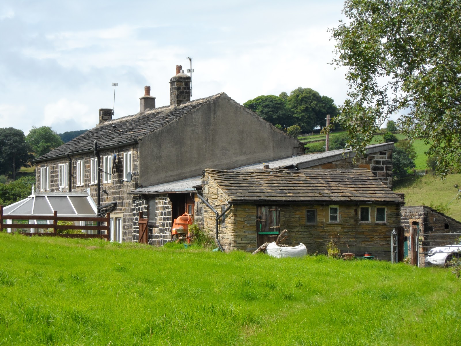
One of the questions that has been bugging me ever since we first saw the property has been it’s age.  Exactly how old is it?

This seems like a hard question to answer – at least, answer accurately.  I am guessing that it was built in the 1800s and I am assuming that some of the interal features might help dated it.  However, often a visit to the Local History unit in the local Library will provide a number of the answers.

Well, I have looked into this will previous properties that I have owned so have an idea about the process.  With this in mind, I visited the Local History unit in Huddersfield central Library.  I was not quite sure how much information I would be able to find – it is very variable depending on the age and area.  However, I was very pleasantly surprised to be able to spot the property on an old map.  First of all, it was definitely there in 1894.  I then looked on the 1854 map and it was there too.  Then onto the oldest map in the library.  And bingo.  It was there too.  In 1788! 

The amazing thing is that the outline of the house really hasn’t changed that much in the past 250 years (it is the “T” shaped building above the letter “A” in “Lower Hagg”.  Just compare the scan from the 1788 map with the image from Google earth on my other posting.  Almost identical.

With the help of the librarians at the library, I looked through the boxes of photos of the area and managed to find an RAF aerial photograph from 1948 that also includes the property. [Incidentally, many of these aerial photographs are available online, however, not the one that I was looking for.  English Heritage maintain and archive of these images online and you can find it here: http://www.britainfromabove.org.uk/.]

A quick through the census for 1901 established that the property (10 Hagg Lane as it was referred to then) was occupied by Smith and Mary Littlewood and their three children (Ernest, Wilfred, and Denis) and a step daughter Evelyn Eastwood.  Their occupations were listed as Woollen Weaver.  The property next door (9 Hagg Lane) is occupied by a 50 year old farm labourer, named Joseph Hobson. The census data can now be accessed online, although I used  the microfiche in the library for this purpose.

All of this I established within a hour, pretty amazing really.

Now to be able to date house any further, I will need to visit the Registry of Deeds in Wakefield.  The Registry of Deeds was established by an Act of Parliament in 1704 to allow land holders to register publicly deeds relating to property.  But this will have to wait for another weekend!

Our first visit to the Planning Dept

I rang the Planning department at Huddersfield County Council earlier in the week.  We made an appointment to discuss the property that we are in the process of buying.  You will find the pages for the Planning Department here.

Before we went in to see the Planning Dept, the feedback was unanimous – it would be a waste of time.

I must admit that I had a whole list of questions which I didn’t ask.  Questions about what was and what wasn’t going to be acceptable.  I decided that it was too early for these sorts of questions, but better to concentrate on finding out more about the property and the planning process.

Was the meeting a waste of time?  Absolutely not!  The naysayers couldn’t have been more wrong. It was a very useful session and, while we are far from being in a position of having planning permission, we did manage to establish a number of things.

Namely:

  • The property is not Listed;
  • The property is not in a conservation area;
  • There are no current applications for planning permission and there is no record of any planning applications having been submitted (or rejected);
  • There are no planning applcations on any of the adjoining properties;
  • There are no Tree Preservation Orders (TPO) on any of the trees on the property;
  • There are TPOs on the trees on woods (Hagg Wood) that encloses the property;
  • Before we submit our application, we can make an appointment and talk through the designs that we would like to submit.  In fact, it would seem to make sense to do this before the plans are too developed as this will save time and money in getting any amendments made.

So all in all, a very useful session.  I have subsequently read that some local councils charge (around £120) for these meetings.  So top marks to Huddersfield local council!

© 2024 Hagg Leys Farm

Theme by Anders NorenUp ↑