Category: Planning (Page 2 of 2)

We have exchanged contracts!

Back in June, I wrote that the journey had begun.  Yesterday, we passed one of the first milestones and exchanged contracts.  At the end of the week, we will complete and the property will belong to us.  Then the first destination on our journey will have been reached.

I have often heard it said that you can buy a house in less than a couple of months.  In my experience, that is pretty unusual – a minimum of three months seems much more likely.  From first seeing the property in June to completing on it in early September isn’t bad going.  But it is difficult to believe that three months has already elapsed.

One thing that I hadn’t banked on was the additional time that it takes to purchase a property of the summer.  Vendors and solicitors going on holiday (not together, by the way) and a long turn around time on local authority searches all added to the timescale.  But we got there in the end.  Thankfully.

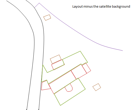
What happens next? Well, the architect is briefed and we are expecting some sketches at the end of September.  Once these are agreed, this will be worked up into a full set of plans for planning submission.  That’s probably going to take another 4-6 weeks.

How accurate is measuring using Google Maps?

Well, now I have an accurate set of floor plans, I can compare the estimates that I worked out using Google Maps (see previous post).

I estimated the overall size of the buildings (including the barn) to be around 20 feet by 80 feet.  The floor plans (and the topo survey) show that the building is in fact 22 feet by 82 feet.  Remarkably close to the Google Map estimate.  I tried a few other measurements that I had taken and they are all within about 10% of the actual measurement – this is particularly the case with longer measurements.  It is pretty scary about how much detail you can glean from these satellite images.

The results of the Bat Survey are in!

Although we are still waiting for the written report, it would appear that we don’t have a problem with bats.  The assessors have confirmed that there are no bats living in any of the buildings and while the survey did reveal bats foraging in some of the tress.  They only recorded one bat during their time (around 3 hours) on site. 

As soon as we have the written report, I will post more information.

Bat Survey

Bats are a protected species in the UK.  This means that it is a criminal offence to intentionally or recklessly kill or capture, disturb a place of shelter or destroy the resting place of a bat.  A roosting site can be protected even if there are no bats present.  Furthermore, a bat survey needs to be undertaken BEFORE a planning application can be determined.

The other compounding fact here is that the survey can only be completed at suitable times of the year, normally May to September. 

In our case, we are not likely to be submitting a planning application until after September, so if it turns out that we need a bat survey then we will have to put everything on hold until the following May when the survey can be completed.  Not a great result.

Talking to the existing owners, it would appear that there are bats in the area, so we have decided to get a bat survey completed now just in case.  But it is another added expense.  Around £1,000.

Using Google Earth to work out the layout of the property

One of the challenges with purchasing Hagg Leys Farm is that we do not have any property details.  We bought the property before the details had been produced and once the property had been sold, there was no interest in producing these.  So we are having problems answering basic questions such as “how many sq ft is the property?”, “How big is the garden?” etc.
As it turns out, the square footage is an important factor in estimating a number of the basic costs so it is important to be able to get an estimate of this, no matter how rough.  It occurred to me that Google Earth might be a good option here.  I zoomed in on the property as much as I could and grabbed the bitmap (using the snipping tool in Windows 7).  I then pasted this into PowerPoint and drew around the outline of the buildings including other features such as the access road and outbuildings.  You can then remove the underlining satellite image to reveal the outline of the property plan.
Two important things to remember.  Firstly, if you shrink the bitmap, make sure that you keep the proportions the same.  Secondly, when you grab the bitmap make sure that you include the scale.  If you do this, you should be able to mention the outline of the buildings.  Using this approach, I managed to estimate that the square footage of the existing building is around 2700 sq feet (excluding the unconverted barn). I could also start to building some outline designs for the renovation as well as calculating the potential increase in square footage.  I used this to provide some illustrations to the architect and it turned to be a really useful process.

It is going to take how long!?!

18 months.  From start to completion.  That’s the architect’s estimate.  It might be a bit shorter – say, 15 months – but not dramatically different from the 18 month estimate.

So how does this stack up?
Initial designs 8-12 weeks
Planning permission 8-10 weeks
Building regulations 8 weeks

So that is 6-9 months before we can even start on the building work.  With the building work estimated to take a further 6-9 months, you can see how an 18 month estimate starts to look like a reasonable guess.

Until the designs are complete, it is going to be difficult to come up with a more accurate estimate in terms of the timing as well as the costs.  I must admit that 18 months seems like an awfully long time.

Newer posts »

© 2024 Hagg Leys Farm

Theme by Anders NorenUp ↑